
پرونده:Inverness UK location map.svg

حجم پیشنمایش PNG این SVG file:۷۶۲ × ۶۰۰ پیکسل کیفیتهای دیگر: ۳۰۵ × ۲۴۰ پیکسل | ۶۱۰ × ۴۸۰ پیکسل | ۹۷۶ × ۷۶۸ پیکسل | ۱٬۲۸۰ × ۱٬۰۰۸ پیکسل | ۲٬۵۶۰ × ۲٬۰۱۶ پیکسل | ۱٬۴۲۵ × ۱٬۱۲۲ پیکسل.
پروندهٔ اصلی (پروندهٔ اسویجی، با ابعاد ۱٬۴۲۵ × ۱٬۱۲۲ پیکسل، اندازهٔ پرونده: ۱٫۵۹ مگابایت)
این پرونده در ویکیانبار موجود است. محتویات صفحهٔ توصیف آن در زیر نمایش داده میشود. |
| توضیح |
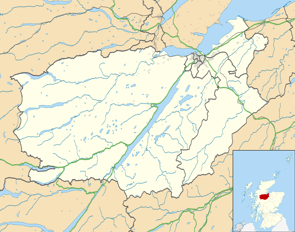
Map of the Inverness city management area, UK in 2011, with the following information shown:
Equirectangular map projection on WGS 84 datum, with N/S stretched 180% Geographic limits:
|
| تاریخ | |
| منبع |
|
| پدیدآور | Nilfanion, created using Ordnance Survey data |
| اجازهنامه (استفادهٔ مجدد از این پرونده) |
این پرونده با اجازهنامهٔ کریتیو کامانز Attribution-Share Alike 3.0 سازگار نشده منتشر شده است. انتساب: Contains Ordnance Survey data © Crown copyright and database right
|
| دیگر نسخهها | File:Inverness UK blank map.svg - Blank map |
تاریخچهٔ پرونده
روی تاریخ/زمانها کلیک کنید تا نسخهٔ مربوط به آن هنگام را ببینید.
| تاریخ/زمان | بندانگشتی | ابعاد | کاربر | توضیح | |
|---|---|---|---|---|---|
| کنونی | ۲۲ فوریهٔ ۲۰۱۱، ساعت ۰۱:۰۹ | | ۱٬۴۲۵ در ۱٬۱۲۲ (۱٫۵۹ مگابایت) | Nilfanion | {{Information |Description=Map of the Inverness city management area, UK in 2011, with the following information shown: *Ward boundaries *Coastline and lakes *Roads and railways *Urban areas Equirectangular map projection on WGS 84 datum, |
کاربرد پرونده
صفحههای زیر از این تصویر استفاده میکنند:
کاربرد سراسری پرونده
ویکیهای دیگر زیر از این پرونده استفاده میکنند:
- کاربرد در ar.wikipedia.org
- کاربرد در ceb.wikipedia.org
- کاربرد در en.wikipedia.org
- Fort Augustus
- Fort George, Highland
- Culloden, Highland
- Urquhart Castle
- Invermoriston
- Caledonian Stadium
- Drumnadrochit
- Merkinch
- Raigmore Hospital
- Cawdor
- Aberarder
- Abriachan
- Achnaconeran
- South Kessock
- Beauly
- Millburn, Inverness
- Smithton, Highland
- Westhill, Highland
- Balloch, Highland
- Tomatin
- Cannich
- Cabrich
- Scorguie
- Tornagrain
- Balnain
- Ardendrain
- Ardnagrask
- Croy, Highland
- Talk:Smithton, Highland
- Kiltarlity
- Dores, Highland
- Moy, Highland
- Achnabat
- Allanfearn
- Aigas
- Aldourie
- Bunloit
- Foyers, Highland
- Balbeg, Highland
- Bunchrew
- Barnyards, Highland
- Gorthleck
- Crask of Aigas
- Leachkin
- Inverfarigaig
- Camault Muir
- Corrimony
- Wester Aberchalder
نمایش استفادههای سراسری از این پرونده.