
پرونده:West Midlands UK location map.svg

حجم پیشنمایش PNG این SVG file:۸۰۰ × ۵۴۷ پیکسل کیفیتهای دیگر: ۳۲۰ × ۲۱۹ پیکسل | ۶۴۰ × ۴۳۷ پیکسل | ۱٬۰۲۴ × ۷۰۰ پیکسل | ۱٬۲۸۰ × ۸۷۵ پیکسل | ۲٬۵۶۰ × ۱٬۷۵۰ پیکسل | ۱٬۴۲۵ × ۹۷۴ پیکسل.
پروندهٔ اصلی (پروندهٔ اسویجی، با ابعاد ۱٬۴۲۵ × ۹۷۴ پیکسل، اندازهٔ پرونده: ۱٫۳۵ مگابایت)
این پرونده در ویکیانبار موجود است. محتویات صفحهٔ توصیف آن در زیر نمایش داده میشود. |
| توضیح |
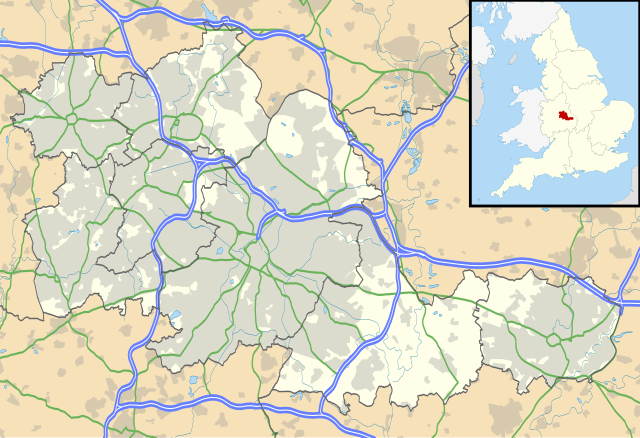
Map of the West Midlands, UK with the following information shown:
Equirectangular map projection on WGS 84 datum, with N/S stretched 160% Geographic limits:
|
| تاریخ | |
| منبع |
|
| پدیدآور | Nilfanion, created using Ordnance Survey data |
| اجازهنامه (استفادهٔ مجدد از این پرونده) |
این پرونده با اجازهنامهٔ کریتیو کامانز Attribution-Share Alike 3.0 سازگار نشده منتشر شده است. انتساب: Contains Ordnance Survey data © Crown copyright and database right
|
| دیگر نسخهها | File:West Midlands UK district map (blank).svg - Blank map |
.svg)
تاریخچهٔ پرونده
روی تاریخ/زمانها کلیک کنید تا نسخهٔ مربوط به آن هنگام را ببینید.
| تاریخ/زمان | بندانگشتی | ابعاد | کاربر | توضیح | |
|---|---|---|---|---|---|
| کنونی | ۲۶ سپتامبر ۲۰۱۰، ساعت ۱۹:۱۷ | | ۱٬۴۲۵ در ۹۷۴ (۱٫۳۵ مگابایت) | Nilfanion | {{Information |Description=Map of the West Midlands, UK with the following information shown: *Administrative borders *Coastline, lakes and rivers *Roads and railways *Urban areas Equirectangular map projection on WGS 84 datu |
کاربرد پرونده
صفحههای زیر از این تصویر استفاده میکنند:
کاربرد سراسری پرونده
ویکیهای دیگر زیر از این پرونده استفاده میکنند:
- کاربرد در ar.wikipedia.org
- کاربرد در ast.wikipedia.org
- کاربرد در bg.wikipedia.org
- کاربرد در ceb.wikipedia.org
- کاربرد در en.wikipedia.org
- Moseley
- Moseley and Kings Heath (ward)
- Coventry Cathedral
- Coventry Transport Museum
- 2002–03 FA Premier League
- 2003–04 FA Premier League
- Walsall
- West Bromwich
- Dudley
- Tipton
- Birmingham Airport
- Soho House
- Aston
- Smethwick
- Oldbury, West Midlands
- Rowley Regis
- Birmingham Town Hall
- Birmingham Museum and Art Gallery
- Aldridge
- Sutton Coldfield
- Bilston
- Sutton Park, West Midlands
- Blackheath, West Midlands
- Black Country Living Museum
- Dudley Castle
- Willenhall
- Halesowen
- Knowle, West Midlands
- Stourbridge
- Brierley Hill
- Brownhills
- Hampton in Arden
- Spaghetti Junction, Birmingham
- Edgbaston
- Sedgley
- Harborne
- Soho, West Midlands
- Birmingham Botanical Gardens, England
- 2004–05 FA Premier League
- Thinktank, Birmingham Science Museum
- Bournville
- Hall Green
- Northfield, Birmingham
نمایش استفادههای سراسری از این پرونده.